Research Opportunities
The ACE Basin Reserve provides an ideal platform for outside researchers to work in large expanses of relatively undeveloped coastal ecosystems. Every year, the reserve hosts students and researchers from across the country. The ACE Basin research staff are very receptive to graduate students and faculty researchers who wish to collaborate on research questions of particular interest to the Reserve.
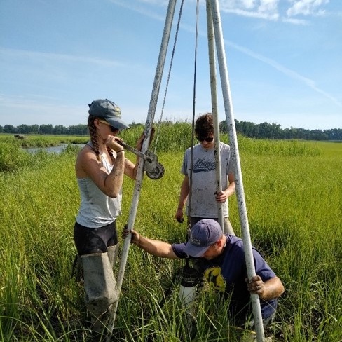
Our existing monitoring and research efforts provide a foundation for collecting additional data and information to answer a wide range of research questions. The long-term weather and water quality data we collect, along with the habitat maps we develop, are available online (see links below). Surface elevation and marsh health data are additionally available upon request. All of these resources provides an amazing platform for new research projects.
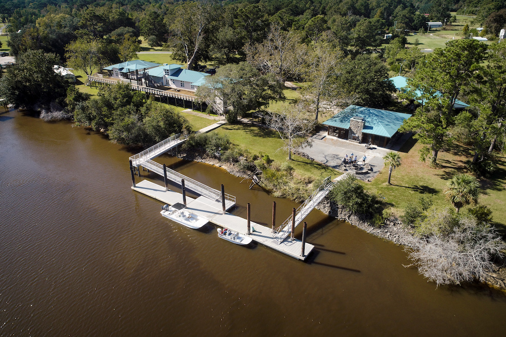
McKenzie Field Station
The ACE Basin NERR operates the Michael D. McKenzie Field Station at Bennett’s Point, South Carolina, 45 miles south of Charleston. The 4,000 square-foot facility contains offices, wet/dry labs, a conference room and an outdoor classroom. Dormitory and kitchen accommodations and docking facilities are available free of charge for overnight stays by visiting scientists.
Current projects based out of Bennett’s Point include long-term water quality and meteorological monitoring, shoreline stabilization, invasive species removal, oyster reef construction, and more. Nearby locations include Donnelly WMA, Bear Island WMA, the Edisto Learning Center, and Nemours Wildlife Foundation.
To reserve the facilities, contact the McKenzie Field Station at (843) 844-8822.
Resources for Researchers
Water & Weather Data

Open this application to view, chart and download all of the water and weather data collected since 1995 at our monitoring stations across the Reserve.
ACE Basin Habitat Maps
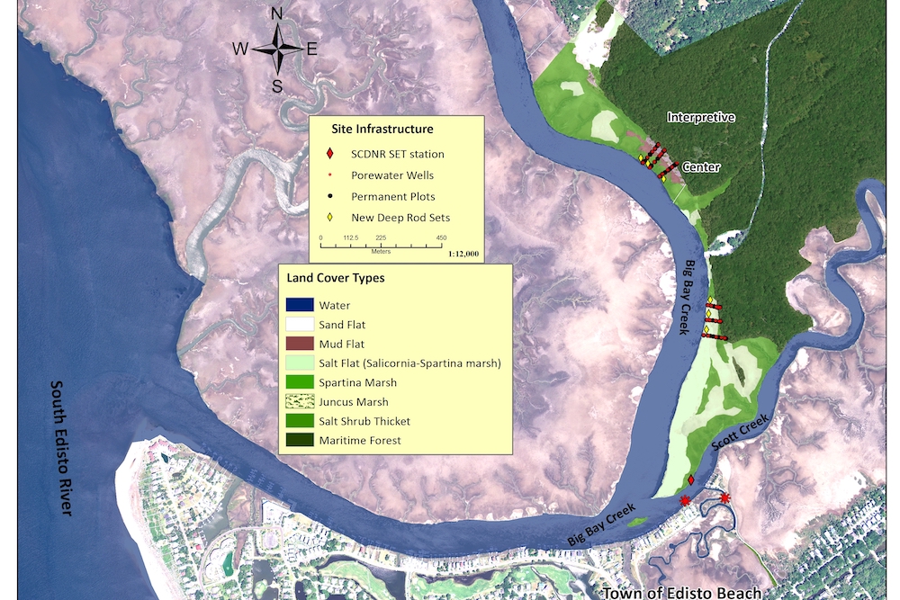
The GIS application gives users access to Reserve boundary, watershed boundary and high-resolution habitat maps.
Real-Time Data
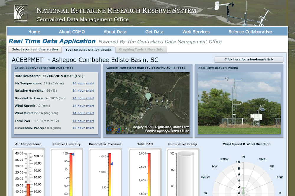
The Real Time Application allows users to view near real-time data, real-time gauges, and 24-hour graphs with multiple parameters.
Graduate Research Fellowship
An exciting new fellowship program is available for graduate students at national estuarine research reserves across the country, including the ACE Basin Reserve. One two-year fellowship opportunity will be available at each of the 29 coastal sites. Through a research project, fellows will address a key coastal management question to help scientists and communities understand coastal challenges that may influence future policy and management strategies.
Learn More About the Graduate Research Fellowship