KML (Keyhole Markup Language) is a file format used to display geographic data in mapping applications. It was originally developed for use with Google Earth, but has since been adopted by various mapping and geospatial software.
.kml files are XML-based and use a combination of points, lines, polygons, images, and textual descriptions to depict geographic features. These features can be explored by opening the files in free, open-source software, such as Google Earth or QGIS, making them a useful format for disseminating geologic data to the public.
Below, you can download KMLs that contain surficial geology data from key focus areas of the state. If you are interested in KMLs of an area that is not represented here, feel free to contact a member of our GIS staff for assistance with your request.
ACE Basin National Wildlife Refuge
- Contains 9 quadrangles: Dale, Wiggins, Bennetts Point, Edisto Island, Beaufort, Frogmore, Saint Helena Sound, Edisto Beach, Fripp Inlet
- To request a more detailed report on one or more quadrangles, see the Publications page for ordering information.
- Download: ACE_Basin.kml
The Ernest F. Hollings ACE Basin National Wildlife Refuge, steeped in cultural history and natural resources, is located within the larger 350,000-acre Ashepoo-Combahee-Edisto (ACE) Basin System, which represents one of the largest undeveloped wetland ecosystems remaining on the Atlantic Coast. The Ashepoo, Combahee, and Edisto Rivers form the extensive estuaries and sections of the Refuge boundary. E.F.H. ACE Basin NWR comprises two units, the Combahee and Edisto, which encompass bottomland and upland forests, fresh and salt water marsh and managed impoundments.
— U.S. Fish & Wildlife Service
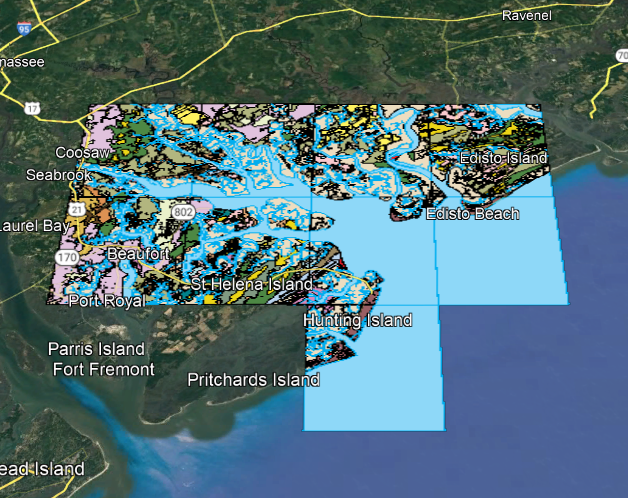
Preview of ACE_Basin.kml
I-73 Corridor
- Contains 6 quadrangles: Fork, Adrian, Bayboro, Galivants Ferry, Nichols, Mullins
- To request a more detailed report on one or more quadrangles, see the Publications page for ordering information.
- Download: I-73_Corridor.kml
The I-73 corridor aims to bring growth to six states: Michigan, Ohio, West Virginia, Virginia, North Carolina and South Carolina. When completed, it will connect the Myrtle Beach area to South Carolina's interstate system, with the interstate itself leading up to Sault Ste. Marie, Michigan. Currently, the only finished portions of I-73 reside in North Carolina, though construction is near beginning in South Carolina.
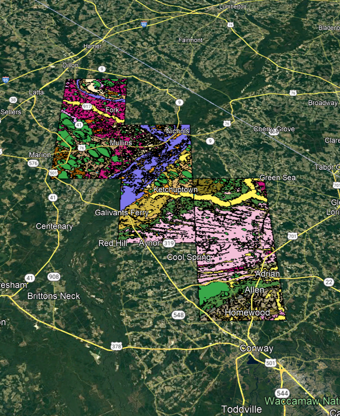
Preview of I-73_Corridor.kml
Cedar Creek
- Contains 1 quadrangle: Cedar Creek
- To request a more detailed report on one or more quadrangles, see the Publications page for ordering information.
- Download: CedarCreek.kml
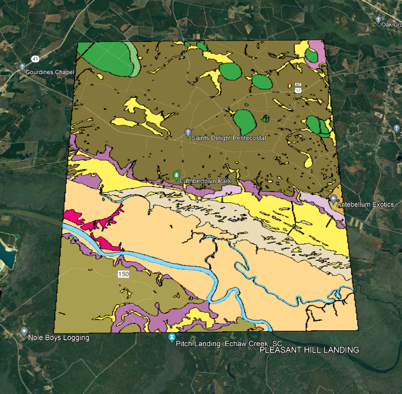
Preview of CedarCreek.kml