Map Production
FIS and FIRM Production
Prior to starting the engineering analysis, there are several datasets that must be acquired. Hydrological characteristics, topography, land use, and infrastructure data are utilized to assess and evaluate the potential risks and impacts of flooding in a given area.
After data collection, the engineering analysis begins. The level of engineering analysis depends on what study type will be conducted. There are different levels of study types.
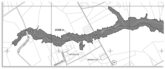
Approximate A study - The SFHA (Special Flood Hazard Area) has been determined using H&H analysis but has not been field verified. There are no BFEs or floodways on the FIRM with this type of study. The H&H models provide the Water Surface Elevation, which may be used as best available data in appropriate situations.
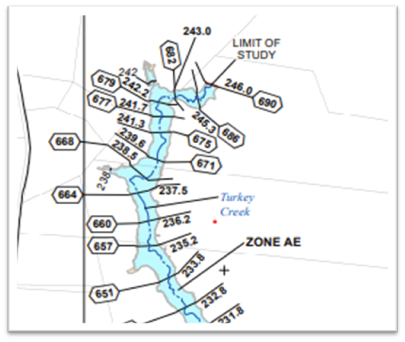
Limited Detailed Study - The SFHA has an established BFE with numbered cross sections, but there is no mapped floodway.
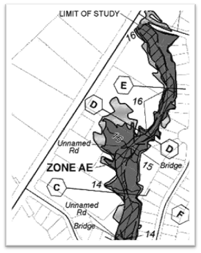
Fully Detailed Studies - The SFHA has BFEs and a floodway. There are lettered cross sections and a floodway data table and/or profile in the FIS.
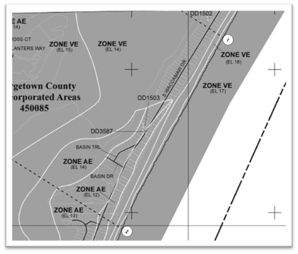
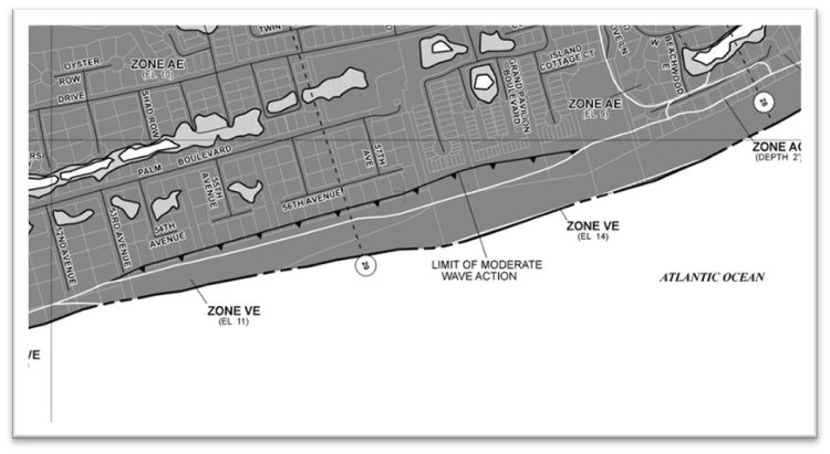
Coastal Study - Are used in areas with wave action and velocity. There can be AE and VE zones in a coastal study. VE zones are delineated where the wave action is determined to be 3 ft or higher. AE zones are where wave action is less than 3 ft. There are static (in parenthesis) BFEs and transects instead of cross sections. Coastal studies have a transect data table in the FIS. Coastal studies may extend far inland into rivers. A static BFE in an AE zone on a river is an indication that flooding is dominated by the Atlantic Ocean, not the river.
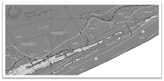
LiMWA (Limit of Moderate Wave Action) - LiMWA lines are located where the wave action is determined to be 1.5 ft. The area between the LiMWA line and VE zone line has a wave action between 3 and 1.5 ft. and is called the Coastal A zone. Based on past events and FEMA analysis, it has been determined that this level of wave action can create significant damage to structures, and it is recommended that VE zone standards be applied in the Coastal A zones. The arrows on a LiMWA line point towards the VE zone. VE zones can be determined to exist on the back sides of islands due to regeneration of wave action. Therefore, additional LiMWA lines may exist, and the resulting arrows may point landward, such as in the example below.
Quality Assurance and Quality Control
The engineering analysis and mapping is reviewed to ensure that FEMA’s standards are met.
Preliminary Maps Distributed
The preliminary panels and FIS are printed, and paper copies are distributed to each community for review. There is a 30-day comment period after the preliminary panels and FIS have been distributed. Each community will be notified that paper copies of the maps are being distributed.

 Facebook