Characterization of the Ashepoo-Combahee-Edisto (ACE) Basin, South Carolina
Water Quality
Water resources in the ACE Basin include rivers, streams, estuaries, wetland impoundments, and ground water. People use these waters for different purposes such as swimming, fishing, drinking, agriculture, and industry. The advent of industrialization and rapidly increasing human population has increased the demand for water and necessitated higher water quality standards. The Clean Air Act (CAA) is a federal law passed in 1970 and amended in 1990 and 1997, that forms the basis for the national air pollution control effort. The CAA assigns primary authority to the states to set their own water quality standards, but requires that all states comply with the "fishable and swimmable" goal of the Act through establishment of beneficial uses and water quality criteria. In South Carolina, the South Carolina Department of Health and Environmental Control (SCDHEC) is the primary authority on water quality issues.
Industrial development in the ACE Basin is minimal with National Pollutant Discharge Elimination System (NPDES) permits issued for 13 municipal and industrial facilities. Discharges from these constitute only a portion of the total pollutant input to the ACE Basin ecosystem. Runoff from urban, industrial, and agricultural activities, either in the Basin or from areas upstream, is a significant source of pollution. Although most water quality degradation is due to anthropogenic influences, there are natural events, such as hurricanes and torrential rainfall, which can impact water and sediment quality. Thus, the quality of water resources in the ACE Basin is affected by both natural and anthropogenic events; however, it is often difficult to distinguish between the two because the effects of natural events are often intensified by man's activities. This module discusses the relationship of water quality issues to the ACE Basin ecosystem, possible mechanisms to mediate the problems, and the importance of each issue nationally and regionally.

Eutrophication is an increase in nutrient concentrations (e.g. nitrogen, phosphorus) above natural levels and the effects caused by this increase (Frithsen 1989; Nixon 1995). Nutrient sources that affect water bodies include wastewater treatment plant discharges and nonpoint source runoff from atmospheric deposition or agricultural fertilization. The adverse effects associated with eutrophication in estuaries include increases in primary productivity, changes in algal species composition, changes in benthic community structure and function, and declines in oxygen concentrations. Eutrophication is currently the most widespread water quality problem in the nation and accounts for about 60% of the impaired conditions of rivers in the U.S. Moderate concentrations of nitrogen and phosphorus were found in St. Helena Sound in the ACE Basin (NOAA 1996); however, the levels of nitrogen and phosphorus in the ACE Basin are below those of concern for eutrophication. The most effective management practices of eutrophication should be aimed at reducing the levels of nutrients reaching a water body rather than treating the water body once a problem has occurred. Such practices include stormwater control plans, enhanced treatment of effluents, and best management practices for agriculture.

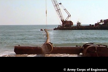
Turbidity and sedimentation can influence water quality. Both processes can be greatly accelerated by urban land use, agriculture, timber harvesting, and development. Sedimentation rates are naturally high in estuaries; however, poor soil conservation practices and alterations of natural circulation patterns have increased the rates of filling (Schubel 1977). Increased turbidity and suspended sediments can result in a sag in dissolved oxygen from increased biological oxygen demand, reduced photosynthetic production of oxygen, and resuspension and redistribution of toxic chemicals. An increase in turbidity has been found in the ACE Basin at SCDHEC monitoring stations over the last few years (SCDHEC 1995 1997). Shoaling in the Fenwick Cut has increased by 130% in the last decade, suggesting that this area is an effective trap for suspended sediments (Alexander and Wenner 1995). The concurrence of dredging activities over the period when rapid accumulation rates were seen in the Ashepoo subtidal area suggests that dredging may have a significant impact on concentrations of suspended sediment in the ACE Basin (Alexander and Wenner 1995). dredgingThere have been no studies conducted in the ACE Basin on boating impacts to shorelines, but sites in the ACE Basin such as Fenwick Island and the shoreline of Mosquito Creek are experiencing rapid erosion. Management of turbidity and sedimentation needs to be accomplished by government agencies at all levels. In addition, outreach programs are needed that inform and educate residents in the ACE Basin study area about the effects of soil erosion and sedimentation, as well as the implementation of best management practices that will prevent this type of pollution. An understanding of the relative impacts of different land uses (e.g. agricultural, residential, or urban) on water quality is critical to the management of turbidity and sedimentation. Ultimately, South Carolina state agencies will need to work with local governments to develop a system of comprehensive planning for locating boat landings and marinas.
Simulation of the effects of potential changes in land use on water quality is provided through preliminary results of a modeling effort implementing the Non-Point Source Pollution Module (NPSM) of the EPA Better Assessment Science Integrating Point and Nonpoint Sources (BASINS) tool. BASINS was developed for improving assessment and integration of point and nonpoint sources in watershed and water quality management. The project is intended to explore the applicability of NPSM to coastal (tidally influenced) watersheds and specifically to establish long-term management policies for the ACE Basin. While this is the first step in preparation of a calibrated simulation, collection of the necessary field data on actual water quality was not part of this study. This model simulates water flow and sediment transport in the nine sub-basins of the Ashepoo River. The uncalibrated results reveal that total sediment concentrations (in mg/l) closely follow storm-related increases in volumetric discharge. Of the three sediment sizes simulated, sand loads appear to dominate the response. Silt and clay represent a very small portion of the total load and are only significant during storm peaks. However, as each storm event is unique in terms of rainfall intensity, duration, and antecedent conditions, the stream response also varies substantially. From this information, predictions of long-term rates of soil erosion, stream turbidity, and storm hydrographs accounting for sub-basin land use distributions are possible. Means for visualizing the model outputs are provided.
Hypoxic water is defined as dissolved oxygen (DO) concentrations below 2 ppm, which is the minimum level required to support most animal life and reproduction. DO levels naturally fall below 2 ppm for short periods of time in estuarine systems (Diaz and Rosenberg 1995; Lerberg 1997); but if hypoxia occurs in a water body for long periods of time, then the aquatic biota can be adversely impacted. In general, except for portions of the Combahee and Ashepoo Rivers, DO levels measured in the ACE Basin by SCDHEC were above the DO standards (4 mg/l). Intensive sampling in the South Edisto River by the ACE Basin NERR revealed that hypoxic conditions (< 28% saturation or 2 mg/l) occurred in every season, but were most common in the summer. It appears that these hypoxic conditions are natural occurrences in shallow tidal systems where there is high natural organic input. Land use management appears to be very important in maintaining adequate DO levels. Agencies responsible for water quality monitoring should implement sampling programs that continuously take DO measurements at a wide spatial scale in the ACE Basin, and use the data to develop models that can be used to predict oxygen conditions in tidal creeks (Lerberg 1997). Inadequate data may substantially underestimate the extent of hypoxia in estuarine areas such as the ACE Basin.
The presence of pathogens (i.e. biopollutants) in the water is the most common risk to human health associated with water quality. The rural nature of the ACE Basin along with its significant areas of protected land may insinuate minimal biopollutant problems associated with human activities. However, the most pressing biopollutant problem faced in the ACE Basin is the frequent closure of shellfish beds due to human and animal pathogens. Localized areas of consistent noncompliance with fecal coliform standards and increasing trends in fecal coliform water concentrations do exist. The urbanized areas of Beaufort, Edisto Beach, and Walterboro produced frequent fecal coliform excursions within their watersheds and displayed increasing trends in concentrations. The Ashepoo River downstream of Walterboro had the greatest frequency of fecal excursions, while the most significant increasing trends were on the Coosaw/Whale Branch Creek near Beaufort and Big Bay and Fishing Creeks near Edisto Beach. Frequent excursion rates lead to closure of shellfish beds as evidenced in the closure of all shellfish beds adjacent to Edisto Beach. Nonindigenous pathogens such as Taura virus and white spot virus are also a potential concern in the ACE Basin because of the expansion of aquaculture businesses. Harmful algal blooms have not been a problem in the ACE Basin; however, management of harmful algal bloom events needs to be closely allied with management of eutrophication in the future. This information indicates the Basin is not immune from potential plant and animal health issues associated with biopollutants.
Toxic pollutants, both organic and inorganic, in the water column can have a detrimental impact on water quality and biological communities. Chemical contaminants in the water column generally adsorb to sediment particles that deposit to bottom sediments. Benthic biota are exposed to pollutants accumulated within these sediments and may transfer potentially toxic contaminants through the food web to organisms in higher trophic levels which can cause both acute and chronic toxicity. In general, sediment contaminant concentrations in the ACE Basin are low with little potential for a biological effect (Hyland et al. 1996, 1998; Scott et al 1998). An examination of sediments from the ACE Basin conducted by Scott et al. (1998) found only trace concentrations of chemical contaminants associated with anthropogenic sources. SCDHEC, however, has issued a fish consumption advisory for parts of the ACE Basin due to mercury levels indicating the Basin is not free of chemical contamination. Potential exists for levels to increase significantly in those areas now undergoing urbanization. Agricultural runoff may be a concern for pesticide pollutants in some areas of the ACE Basin. Reduction of chemical contaminants in point source discharges (e.g. factories, storm sewers) and nonpoint source runoff through land use planning is the best management tool to control chemical pollution from entering aquatic systems.
Salinity may be the most important factor affecting the distribution of estuarine organisms. Estuarine salinities fluctuate naturally because of tides and variability in precipitation within the watershed over time. However, anthropogenic changes in land cover, especially creation of impervious surfaces and channelization, greatly alter the natural patterns of freshwater inflow to estuaries. Increases in the impervious surfaces associated with human development that results in increased volume of runoff, combined with the "flashiness" of discharge events, alters the hydrologic cycle (Arnold and Gibbons 1996). Watershed-based zoning and regulations on the impervious surface coverage can contribute to limiting salinity variability and nonpoint source pollution. In the ACE Basin, seasonal and tidal periodicity was found to strongly influence salinity with local changes in precipitation and evaporation being major contributors to monthly variability. One of the most significant problems associated with salinity in the ACE Basin region is saltwater encroachment into ground water aquifers. Presently saltwater encroachment of the Floridan Aquifer under the ACE Basin is occurring because of high water use by Hilton Head and Savannah. Management of saltwater encroachment involves cooperation of federal and state agencies such as U.S. Geological Survey (USGS) and SCDHEC with municipal public service districts.
