ACE Basin/NERR Studies
Long-Term (Sentinel) Monitoring Sites
 In accordance with national guidelines developed by the NERR System, the ACE Basin Reserve has developed long-term monitoring sites on Big Bay Creek (saltwater) and Jehossee Island (brackish water) to study the impacts of sea level and weather pattern changes on coastal habitats. In addition to SWMP stations and detailed elevation and vegetation mapping at each site, the infrastructure includes:
- High Accuracy Local Geodetic Control Network and Tidal Gauge Station at the Big Bay Creek site that connects all components at that location and is tied to local tidal datums and the National Spatial Reference System.
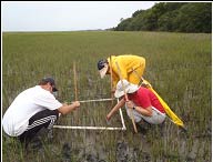
- Permanent Vegetation Monitoring Transects to monitor changes in the composition, quality and quantity of wetland vegetation.
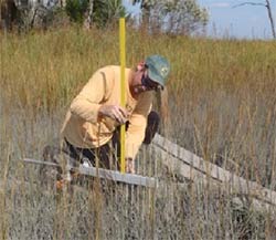
- Surface Elevation Tables (SETs) to measure deposition or accretion of wetland sediments.
- Soil Characteristics and Porewater Chemistry monitored through shallow wells along the permanent vegetation transects.
- Groundwater Dataloggers monitor the freshwater/saltwater dynamics in deeper upland and marsh wells.

