Saltwater Paddling Trail - Savannah River to Beaufort
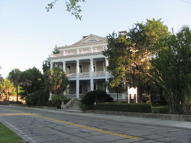
![]() Enter the south end of the trail from access points in Georgia or from South Carolina landing sites that access the Wright River or New River. Important wildlife areas on the paddling trail include Turtle Island Wildlife Management Area, Pinckney Island National Wildlife Refuge, Daws Island Heritage Preserve, Joiner Bank Seabird Sanctuary, Old Island Heritage Preserve, and Hunting Island State Park. Important cultural areas include the Charlesfort-Santa Elana site of 16th century French and Spanish settlements at Parris Island Marine Corps Depot. Haig Point on Daufuskie Island features a historic lighthouse and a modern lighthouse is at Harbor Town, Hilton Head. The City of Beaufort offers cultural charm and a significant historic district. Nearby vacation and beach destinations are at Hilton Head Island, Fripp Island, and Hunting Island State Park.
Enter the south end of the trail from access points in Georgia or from South Carolina landing sites that access the Wright River or New River. Important wildlife areas on the paddling trail include Turtle Island Wildlife Management Area, Pinckney Island National Wildlife Refuge, Daws Island Heritage Preserve, Joiner Bank Seabird Sanctuary, Old Island Heritage Preserve, and Hunting Island State Park. Important cultural areas include the Charlesfort-Santa Elana site of 16th century French and Spanish settlements at Parris Island Marine Corps Depot. Haig Point on Daufuskie Island features a historic lighthouse and a modern lighthouse is at Harbor Town, Hilton Head. The City of Beaufort offers cultural charm and a significant historic district. Nearby vacation and beach destinations are at Hilton Head Island, Fripp Island, and Hunting Island State Park.
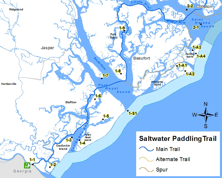
Section 1 Map
Places of Interest on the Trail
| Point No. | Name | Latitude / Longitude | County |
|---|---|---|---|
| 1-1 | South trail entrance at GA-SC border | 32.072992, -80.960482 | Jasper |
| 1-2 | Turtle Island Wildlife Management Area | 32.066044, -80.905666 | Jasper |
| 1-3 | Haig Point Lighthouse on Daufuskie Island | 32.145271, -80.836548 | Beaufort |
| 1-4 | Harbor Town Lighthouse on Hilton Head Island | 32.138660, -80.812778 | Beaufort |
| 1-5 | Hilton Head Island | 32.193817, -80.738163 | Beaufort |
| 1-6 | Pickney Island National Wildlife Refuge | 32.248258, -80.763441 | Beaufort |
| 1-7 | Daws Island Heritage Preserve | 32.303457, -80.741902 | Beaufort |
| 1-8 | Parris Island Marine Corps Depot | 32.316572, -80.680504 | Beaufort |
| 1-9 | City of Beaufort | 32.431581, -80.669828 | Beaufort |
| 1-A1 | Old Island Heritage Preserve/WMA | 32.335945, -80.504127 | Beaufort |
| 1-A2 | Fripp Island | 32.322841, -80.478061 | Beaufort |
| 1-A3 | Hunting Island | 32.378000, -80.454216 | Beaufort |
| 1-A4 | Hunting Island State Park | 32.369073, -80.443742 | Beaufort |
| 1-S1 | Joiner Bank Seabird Sanctuary | 32.216566, -80.659546 | Beaufort |
The Section 1 - Saltwater Paddling Trail Map above has been provided in the Adobe® Acrobat® (PDF) format. Adobe® Reader® is required to open the files and is available as a free download from the Adobe® Web site.
![]()
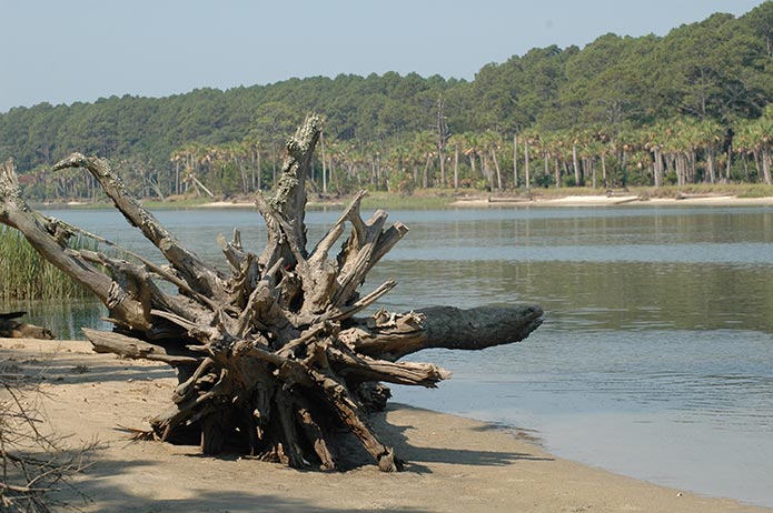
Photograph Gallery of Places of Interest on the Trail
Note: Select thumbnails below to view larger images.