FAQs Regarding Woody Debris and Navigation

The SCDNR often receives calls from the public regarding the removal of woody debris from rivers to allow for unimpeded navigation. The SCDNR does not regulate or permit the removal of woody debris nor have statutory authority to implement the removal of woody debris; however, the SCDNR would like to provide a balanced view regarding woody debris removal in the state’s rivers.
Best Management Practices for Woody Debris Removal for Navigation
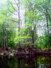
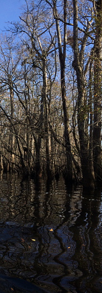
The State navigable waters should remain navigable for recreational use and enjoyment, but the maintenance of the waterways should not have a negative impact on the aquatic resources and the recreational fishery that SCDNR manages for citizens to enjoy. Large woody debris (LWD) is an important part of an aquatic ecosystem, providing habitat diversity for invertebrates, crayfish and fish. The deposition of woody debris and large logs along the channel edges often provide the most productive fish habitat in rivers, so SCDNR recommends that when trees are cleared to allow navigation that the following best management practices for the aquatic resources are considered:
- Cut the minimum amount of woody debris to open a navigation channel passage for a jon boat, canoe or kayak. Use only hand-held tools for the removal, such as chainsaws, axes, and handsaws in the stream channel. Equipment such as bulldozers, tractors, front-end loaders, etc. should not be driven into a stream; if utilized, a permit from the U.S. Army Corps of Engineers may be required.
- Leave most of the tree material within the stream. Do not haul-out large material as this material provides habitat for invertebrates, crayfish, and fish. Brush and fallen trees in a creek provide food, shelter and other benefits to fish and wildlife. Leave as much as possible in a natural condition, untouched by humans.
- Any material removed from the stream cannot be deposited into a wetland without a permit from the U.S. Army Corps of Engineers and/or the Department of Health and Environmental Control.
- As needed, tie off freed trunks and large branches to the banks. This should be done when woody structures may cause navigational hazards. When tying back trees, make sure you have written land ownership permission before entering and tying back trees on private or public property.
- Do not grub (pull out) trees, tree stumps, or tree root masses from the banks. Leaving this debris helps prevent the bank from eroding. A good practice is to leave at least a 50 feet of vegetated, riparian buffer to also promote bank stability.
- Limit the cutting of living trees that are along the banks or those that may be temporarily underwater during high water level periods to prevent bank erosion.
- Cut woody debris during low-flow seasons, preferably during late summer and fall to limit disturbance during fish spawning season.
- Do not remove or alter sand or gravel bars as these provide habitat.
-
Avoid impacting rare, threatened or endangered species. To assess what federally or state listed threated or endangered species may be in the project area, please contact the SCDNR Species Review Team and provide a shapefile, a brief description of the project, and maps of the proposed project area. If the project has a federal nexus (either via a federal permit or federal funding source), the U.S. Fish & Wildlife Service and the National Marine Fisheries Service should also be contacted.
Many of the state’s rivers are designated critical habitat for two species protected under the Endangered Species Act: the Carolina Heelsplitter, a federally endangered freshwater mussel, and the Atlantic Sturgeon, a federally endangered fish species. If the debris clean-up will occur in designated critical habitat and also has a federal nexus (either via a federal permit or federal funding source), please consult with the appropriate agency listed below.
- Carolina Heelsplitter
Critical Habitat Location
U.S. Fish & Wildlife Service Contact:
Mark Caldwell, Deputy Field Supervisor
South Carolina Ecological Services Field Office, South Carolina
843-727-4707 ext. 215 - Atlantic Sturgeon
Critical Habitat Location
National Marine Fisheries Service Contact:
Email: nmfs.ser.esa.consultations@noaa.gov
Phone: (727) 824-5312
- Carolina Heelsplitter
- The SCDNR Scenic River Program has the purpose of protecting unique or outstanding scenic, recreational, geologic, botanical, fish, wildlife, historic or cultural values of selected rivers or river segments in the state. The basis of the program involves river corridor protection through voluntary cooperative community-based processes which allows landowners, community interests and SCDNR to work together toward common river-conservation goals. To maintain the integrity of the Scenic Rivers, it is important to protect the riparian areas and the natural scenic nature for recreational use. Visit www.dnr.sc.gov/water/river to determine if the woody debris removal project will occur in a Scenic River corridor. Please coordinate with the Scenic Rivers coordinator Bill Marshall via email or phone (803) 734-9096.
Logging Operations and Woody Debris

If logging or timbering operations have caused tree material, logs or limbs, to enter the river, then the SC Forestry Commission should be notified; call 803-667-0815. The SC Forestry Commission will investigate, determine if logging/timber harvests are the source of the problem and require removal of the material at the expense of the responsible party.
Federal Navigation Channels
The U.S. Army Corps of Engineers (USACE) is responsible for maintaining the commercial, federal navigation channels in South Carolina. If there are issues in regards to the federal channels listed below, please contact the USACE at https://www.sac.usace.army.mil/Contact/.
Federal Navigation Channels include:
- Adams Creek
- Atlantic Intracoastal Waterway (AIWW)
- Ashley River
- Brookgreen Garden Canal
- Calabash Creek
- Charleston Harbor (including the Cooper River and Town Creek)
- Folly River
- Georgetown Harbor (Winyah Bay, Sampit River, and Bypass Channel)
- Jeremy Creek
- Little River Inlet
- Murrells Inlet (Main Creek)
- Port Royal Harbor
- Shem Creek (including Hog Island Channel & Mount Pleasant Channel)
- Shipyard Creek
- Village Creek
