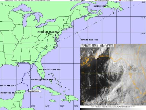

Alberto track and visible satellite picture
Tropical Storm Alberto was a weak tropical storm that briefly reached 60 knot intensity prior to making landfall near Adams Beach, Florida on June 13. After landfall, Alberto weakened rapidly as it traveled over the Florida Panhandle and Georgia. Alberto became extratropical over South Carolina as it became absorbed by a cold front on June 14.
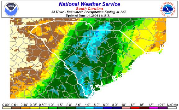
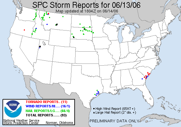
The remnants of Alberto caused heavy rains throughout Central and Coastal South Carolina. Seven tornados were reported and only caused damage to a few roofs, felling several trees and downing power lines in Beaufort and Charleston Counties.

24-Hour Rainfall Total:

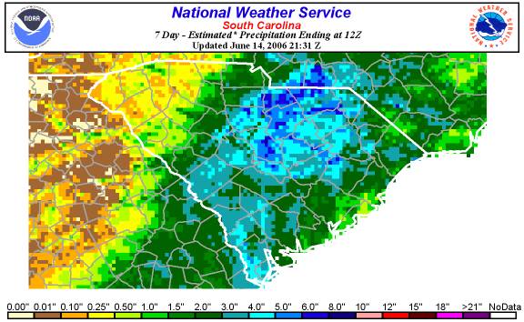
Seven-Day Rainfall Total:
Midlands:
Pageland             4.70
Pageland USGS        6.18
Sandhill             4.85
Black Creek USGS     4.78
Cedar Creek          5.55
McBee USGS           4.61
Columbia Owens AP    3.99
Aiken                3.95
Columbia AP          3.79

South Coast:
Allendale           4.25
Pritchardville      4.23
Bluffton            4.13
Hilton Head         2.94
Beaufort            2.61
Summerville         2.60

Pee Dee:
Cades               3.47
Effingham           3.33
Quinby              2.88
Darlington          3.14
Hartsville          3.35
Florence            2.33

Piedmont:
Chester             3.16
Union               1.50
Lockhart            1.74
Clinton             1.61
Fountain            0.73
Greenwood           0.36

Upstate:
Greer               0.44
Anderson            0.40
Walhalla            0.18
Sandy Springs       0.15
Table Rock          0.12
Lake Bowen          0.08
NWS Dopplerrainfall estimates to include Monday's convection rains preceding tropical event have totaled 7+ inches at locations across the Pee Dee and North Coastal counties.

ACKNOWLEDGEMENTS:
Special thanks to the National Oceanic and Atmospheric Administration and its many divisions for the wealth of weather and climate data made available to prepare this report. Specific thanks to:
Additional thanks to the Naval Research Laboratory Monterey's Marine Meteorology Division for the well-cataloged library of satellite imagery used for this report.
