Saltwater Paddling Trail - Edisto Island to Charleston
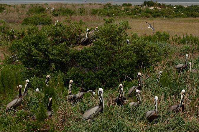
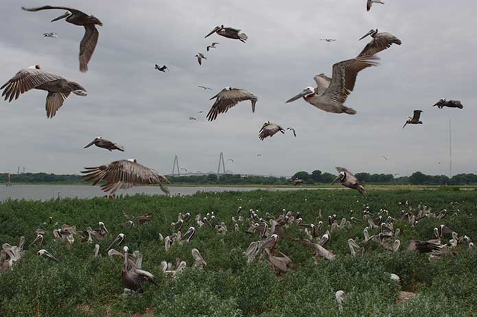
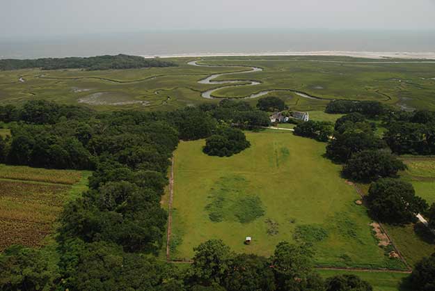
![]() Important natural areas on the paddling trail include Botany Bay Plantation Wildlife Management Area, Deveaux Bank Seabird Sanctuary, Bird Key Stone Seabird Sanctuary, Lighthouse Inlet Heritage Preserve, and Crab Bank Seabird Sanctuary. Important cultural areas on or near the paddling trail include the Morris Island Lighthouse, Charleston Battery, Castle Pinckney historic site, Patriots Point Museum with the USS Yorktown, and Fort Sumter National Monument which includes Fort Moultrie and Sullivan's Island Lighthouse. The port city of Charleston, founded in 1670, is considered a "must see" Old South city widely acclaimed for its charm and beauty and significant historic district. Nearby vacation and beach destinations include Edisto Island, Seabrook Island, Kiawah Island, and Folly Beach.
Important natural areas on the paddling trail include Botany Bay Plantation Wildlife Management Area, Deveaux Bank Seabird Sanctuary, Bird Key Stone Seabird Sanctuary, Lighthouse Inlet Heritage Preserve, and Crab Bank Seabird Sanctuary. Important cultural areas on or near the paddling trail include the Morris Island Lighthouse, Charleston Battery, Castle Pinckney historic site, Patriots Point Museum with the USS Yorktown, and Fort Sumter National Monument which includes Fort Moultrie and Sullivan's Island Lighthouse. The port city of Charleston, founded in 1670, is considered a "must see" Old South city widely acclaimed for its charm and beauty and significant historic district. Nearby vacation and beach destinations include Edisto Island, Seabrook Island, Kiawah Island, and Folly Beach.
Section 3 Map
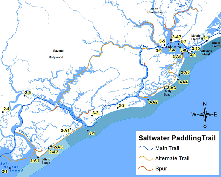
Places of Interest on the Trail
| Point No. | Name | Latitude / Longitude | County |
|---|---|---|---|
| 3-1 | Deveaux Bank Seabird Sanctuary | 32.547490, -80.178041 | Charleston |
| 3-2 | Seabrook Island | 32.588238, -80.163429 | Charleston |
| 3-3 | Kiawah Island | 32.608514, -80.081760 | Charleston |
| 3-4 | Charleston Battery | 32.770009, -79.936882 | Charleston |
| 3-5 | Charleston | 32.776561, -79.930919 | Charleston |
| 3-6 | Castle Pinckney Historical Site | 32.773459, -79.911111 | Charleston |
| 3-7 | Crab Bank Seabird Sanctuary | 32.778440, -79.884733 | Charleston |
| 3-8 | Fort Moultrie National Park | 32.759515, -79.857678 | Charleston |
| 3-9 | Fort Sumter National Monument | 32.755308, -79.853691 | Charleston |
| 3-10 | Sullivan's Island Lighthouse | 32.757823, -79.843249 | Charleston |
| 3-A1 | Botany Bay Plantation Wildlife Management Area | 32.553369, -80.233035 | Charleston |
| 3-A2 | Bird Key-Stone Seabird Sanctuary | 32.630030, -79.983966 | Charleston |
| 3-A3 | Folly Beach | 32.660457, -79.931200 | Charleston |
| 3-A4 | Lighthouse Inlet Heritage Preserve | 32.684053, -79.888859 | Charleston |
| 3-A5 | Morris Island Lighthouse | 32.695389, -79.883595 | Charleston |
| 3-A6 | Fort Sumter National Monument | 32.752408, -79.874852 | Charleston |
| 3-A7 | Patriots Point / USS Yorktown | 32.790285, -79.908532 | Charleston |
The Section 3 - Saltwater Paddling Trail Map above has been provided in the Adobe® Acrobat® (PDF) format. Adobe® Reader® is required to open the files and is available as a free download from the Adobe® Web site.
Photograph Gallery of Places of Interest on the Trail
Note: Select thumbnails below to view larger images.