STATEMAP
Overview
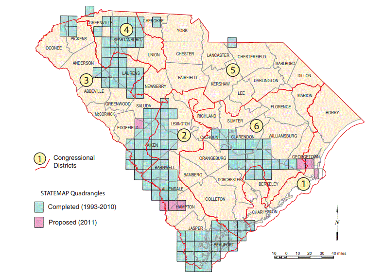
The STATEMAP program is the State Geologic Survey Mapping Component to the National Cooperative Geologic Mapping Program in the USGS. The primary objective of STATEMAP is to establish the geologic framework of areas that are vital to the welfare of individual States. Each State Geologist determines the State's mapping priorities in consultation with a State Mapping Advisory Committee. These priorities are based on State requirements for geologic map information in areas of multiple-issue need or compelling single-issue need and in areas where mapping is required to solve critical Earth science problems. Current mapping status can be viewed on our status map located here.
Funding Sources: USGS and State of SC
Project Contact: Scott Howard
Earth Mapping Resource Initiative (Earth MRI)
Overview
The Earth Mapping Resource Initiative (Earth MRI) is a new partnership between the South Carolina Department of Natural Resources – Geological Survey (SCGS) and the USGS to acquire new topographic, geologic mapping, and geophysical information to help characterize the distribution of critical minerals and identify areas in which more information would improve our understanding of the potential for those critical minerals in South Carolina. Critical minerals are earth materials deemed vital to the United States’ national security and economic prosperity.
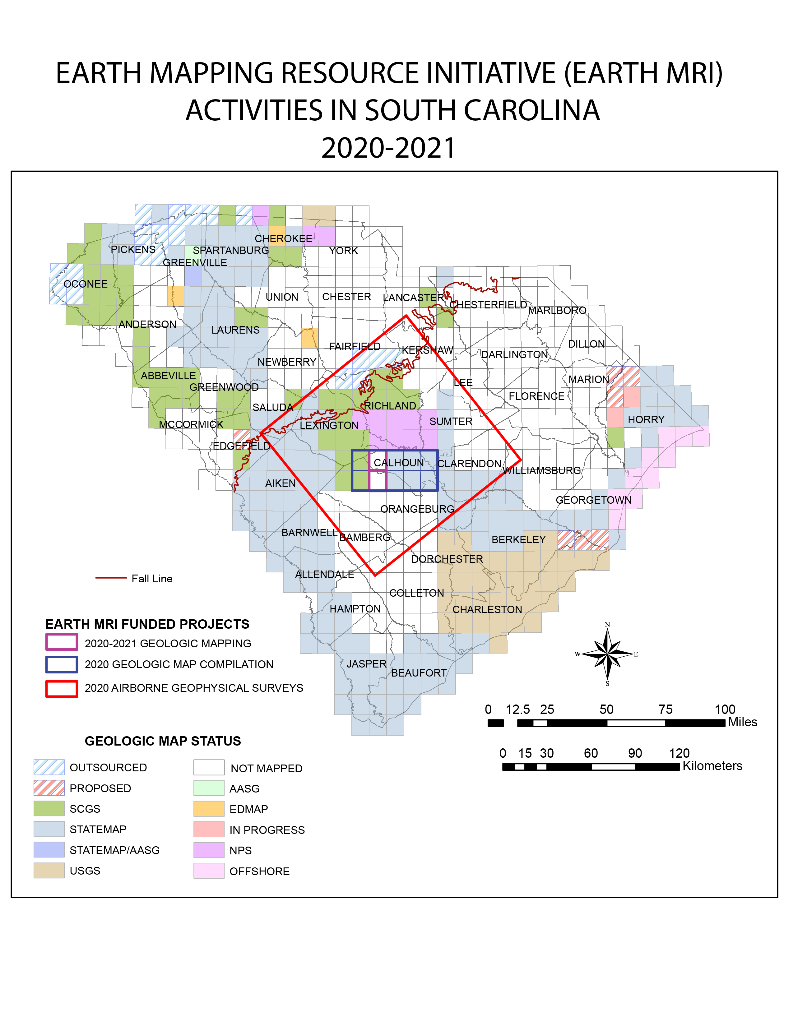
In South Carolina, the current focus of Earth MRI is to collect information related to potential heavy mineral placer deposits located along the Fall Line, the boundary between the Piedmont and the Atlantic Coastal Plain. The critical minerals associated with such deposits include: rare earth elements (REEs), titanium, thorium, and zirconium. The Fall Line area has a history of exploration and mining related to those commodities; and deposits can be identified using existing geophysical, geochemical, and geologic map information. Currently, new high-resolution airborne radiometric and magnetic information are being collected along the Fall Line (Figure). This new information will provide more insights on existing deposits, identify new areas for exploration, and assist the SCGS with new geologic mapping projects. New mapping will help determine the geologic framework of the Fall Line area. As part of this work, the SCGS is producing two new 1:24,000-scale quadrangle maps, updating existing quadrangle maps, and providing a ten-quadrangle geologic map compilation. This new mapping will take place between 2020-2021.
Funding Sources: USGS
Project Contact: Robert Morrow, IV
Shoreline Change Project
Overview
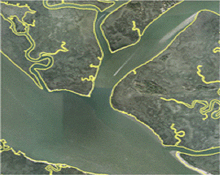
The SCDNR – Geological Survey works on a project supported by the Governors’ South Atlantic Alliance to create digital representations of historical shorelines. The Shoreline Project creates digital shoreline datasets primarily from historical aerial imagery, because they provide for a feature-based methodology and have a high enough resolution to capture detail. The datasets can be used to analyze the physical changes taking place in the coastal and estuarine systems of South Carolina. Additionally, this project looks at the feasibility of developing shoreline vulnerability indices for use by planners.
Funding Sources: Governors’ South Atlantic Alliance
Project Contact: Katie Luciano
Geologic Hazards Mapping
Overview
The SC Emergency Management Division and the Federal Emergency Management Agency has provided us with a grant to study and map the potential risks of several geologic hazards. Specifically, the impact that sinkholes, landslides and liquifaction could have on the States infrastructure. Earthquakes are a known hazard in South Carolina as demonstrated by the 1886 Charleston Earthquake that caused major damage in the low country and was felt as far away as Chicago, IL. The Union County Earthquake in 1913 happened along what is now known as the Eastern Piedmont Fault System. Recent studies by the Survey have revealed a possible reactivation of that fault system. Earthquakes are not the only geologic hazard worth studying in South Carolina. Landslides have also proven to be a major hazard. Evidence of the mass-wasting in the Jones Gap Landslide can be seen in these photos. In the Upper and Middle Coastal Plain there is a potential for sinkholes because of the large areas of loose sand overlying the Santee Limestone. We are currently conducting research on the Union County 1913 Earthquake and compiling observations of liquefaction sites associated with the Charleston 1886 Earthquake. The latest publication focused on the hazards in the Coastal Plain.
Funding Sources: SCEMD and FEMA
Project Contact: Robert Morrow, IV
Outsourced Mapping
Overview
SCGS supports professional and academic geologists to produce a variety of geologic maps for the State. A State Survey is often times the only opportunity for these highly knowledgeable individuals to have their maps published and into the hands of decision makers. To date, 19 published maps are authored by non-staff geologists. Occasionally, these maps are grant-funded to help offset the cost of field materials and transportation. Past contributors to the outsourced mapping program include Dr. Donald Secor, USC (Retired), Dr. Robert Hatcher, Univ. of Tennessee (Retired), and Dr. Jack Garihan, Furman University (Retired).
Funding Sources: State of SC
Project Contact: Scott Howard
SET Project
Overview
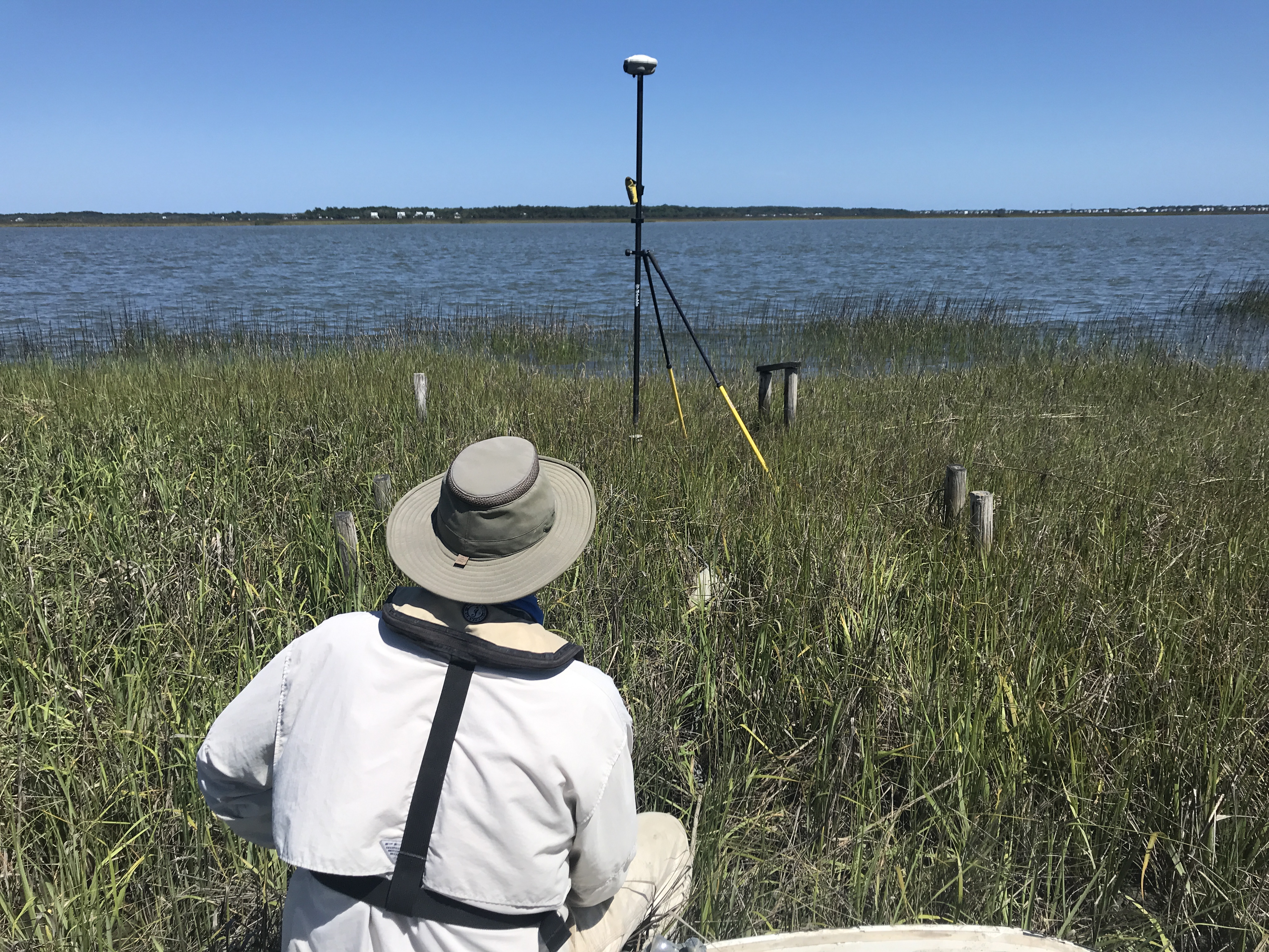
The SET Project (Surface Elevation Table) is the South Carolina Geological Survey’s 20+ year program in intertidal salt marshes investigating geodetic elevation change and those marsh’s response to potential uplift, subsidence, and sea-level rise. The project’s network of 26 stations (as of December 2021) spans from North Carolina to Georgia. The primary objectives are to periodically collect geodetic elevation data (to evaluate for long-term regional uplift or subsidence), and surface elevation data (to evaluate site-specific short-term surface elevation changes). The detailed history and protocols of the SET Project are located here.
Funding Sources: State of SC
Project Contact: Will Doar
Other Projects
- Data Preservation (2019)
Digital Product Refinement
- New Map Digitization
- Historic Map Conversion
Outreach and Education
- Web Site
- Education Materials Development
- South Carolina Geology Journal
- Core Repository
- Minerals and Rocks of SC Study Kits
- Economic Development
