
Scenic Rivers - Map
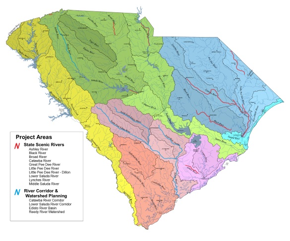
South Carolina contains 30,000 miles of rivers and streams that drain waters from the State's 20-million acres of land and eventually flow to the Atlantic Ocean. Ten (10) rivers are designated as State Scenic Rivers and are presented in red on the map above, and their total length is 400 river miles.
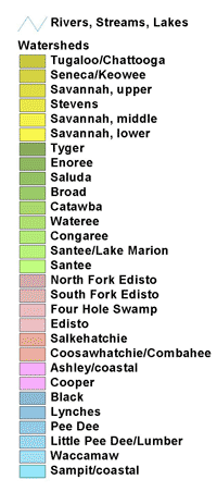
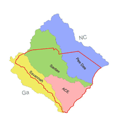
Watersheds, the land areas drained by rivers, are sometimes lumped into larger areas called river basins. The small map (below) shows four river basins of South Carolina - the Savannah, Santee, Pee Dee and the ACE (Ashley-Cooper, Combahee-Coosawhatchie, and Edisto). Only the ACE basin lies completely within South Carolina. The others drain parts of North Carolina and Georgia.
Within the four river basins of South Carolina are 29 rivers and watersheds, and these are listed to the right and featured on the map above. (See link below for larger map.)
The Map of the SC Scenic Rivers above is provided for downloading in the Adobe PDF format.