Saltwater Paddling Trail -
Socastee to Little River, the Intracoastal Waterway
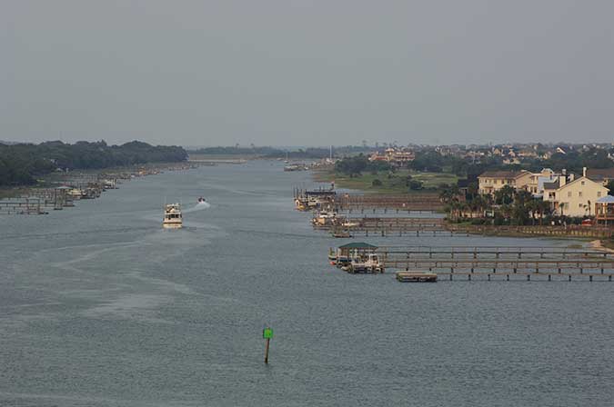
![]() This portion of the trail follows a 30-mile canal created in 1936 by the US Army Corps of Engineers for the Atlantic Intracoastal Waterway. Here the paddling trail generally parallels the popular tourist area of the Grand Strand, which encompasses Myrtle Beach, a dozen other beach communities, plus Myrtle Beach State Park. The Governor's Lighthouse and Vereen Memorial Gardens Park are adjacent to the trail at the Town of Little River.
This portion of the trail follows a 30-mile canal created in 1936 by the US Army Corps of Engineers for the Atlantic Intracoastal Waterway. Here the paddling trail generally parallels the popular tourist area of the Grand Strand, which encompasses Myrtle Beach, a dozen other beach communities, plus Myrtle Beach State Park. The Governor's Lighthouse and Vereen Memorial Gardens Park are adjacent to the trail at the Town of Little River.
Section 7 Map
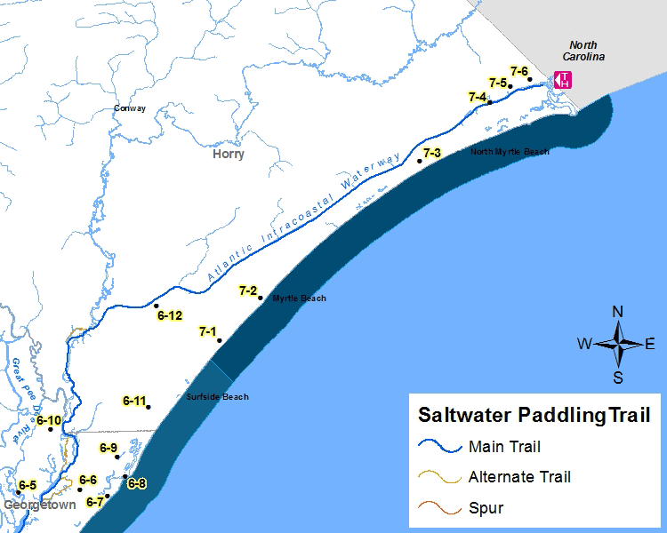
Places of Interest on the Trail
| Point No. | Name | Latitude / Longitude | County |
|---|---|---|---|
| 7-1 | Myrtle Beach State Park | 33.651296, -78.931396 | Horry |
| 7-2 | Myrtle Beach | 33.689060, -78.886694 | Horry |
| 7-3 | Grand Strand | 33.808141, -78.713188 | Horry |
| 7-4 | Governors Lighthouse | 33.859842, -78.637164 | Horry |
| 7-5 | Town of Little River | 33.873228, -78.614186 | Horry |
| 7-6 | Vereen Memorial Historical Gardens | 33.879549, -78.593474 | Horry |
The Section 7 - Saltwater Paddling Trail Map above has been provided in the Adobe® Acrobat® (PDF) format. Adobe® Reader® is required to open the files and is available as a free download from the Adobe® Web site.
![]()
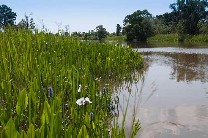
Photograph Gallery of Places of Interest on the Trail
Note: Select thumbnails below to view larger images.