Saltwater Paddling Trail - Beaufort to Edisto Island, the ACE Basin
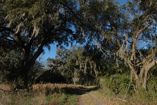
![]() The paddling trail enters the ACE Basin National Estuarine Research Reserve (NERR) as it passes through waters of St. Helena Sound and the Ashepoo, Edisto, and Combahee (ACE) Rivers. The ACE Basin NERR is one of 27 national reserves located along the US coastline. This NERR is a significant portion of the greater ACE Basin Project focus area, which has been the target of significant public and private land conservation. Related areas near to the paddling trail include the ACE Basin National Wildlife Refuge and Bear Island Wildlife Management Area. Nearby vacation and beach destinations include Edisto Island, Edisto Beach, and Edisto Beach State Park.
The paddling trail enters the ACE Basin National Estuarine Research Reserve (NERR) as it passes through waters of St. Helena Sound and the Ashepoo, Edisto, and Combahee (ACE) Rivers. The ACE Basin NERR is one of 27 national reserves located along the US coastline. This NERR is a significant portion of the greater ACE Basin Project focus area, which has been the target of significant public and private land conservation. Related areas near to the paddling trail include the ACE Basin National Wildlife Refuge and Bear Island Wildlife Management Area. Nearby vacation and beach destinations include Edisto Island, Edisto Beach, and Edisto Beach State Park.
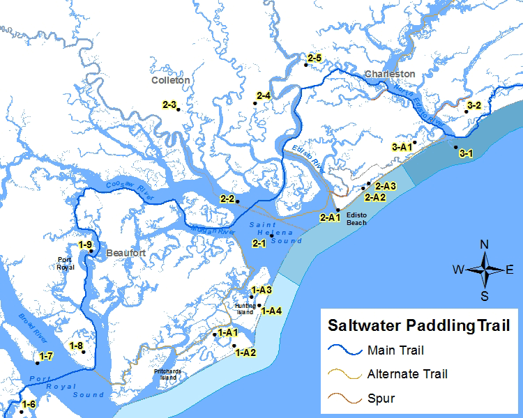
Section 2 Map
Places of Interest on the Trail
| Point No. | Name | Latitude / Longitude | County |
|---|---|---|---|
| 2-1 | St. Helena Sound | 32.448308, -80.426754 | Colleton |
| 2-2 | ACE (Ashepoo, Edisto, Combahee) Rivers | 32.487158, -80.471735 | Colleton |
| 2-3 | ACE Basin NERR | 32.592680, -80.551171 | Colleton |
| 2-4 | Bear Island Wildlife Management Area | 32.599618, -80.447866 | Colleton |
| 2-5 | Earnest F. Hollings ACE Basin NWR | 32.643148, -80.378710 | Charleston |
| 2-A1 | Edisto Beach | 32.477297, -80.336827 | Colleton |
| 2-A2 | Edisto Island | 32.501298, -80.302877 | Colleton |
| 2-A3 | Edisto Beach State Park | 32.506816, -80.295339 | Charleston |
The Section 2 - Saltwater Paddling Trail Map above has been provided in the Adobe® Acrobat® (PDF) format. Adobe® Reader® is required to open the files and is available as a free download from the Adobe® Web site.
![]()
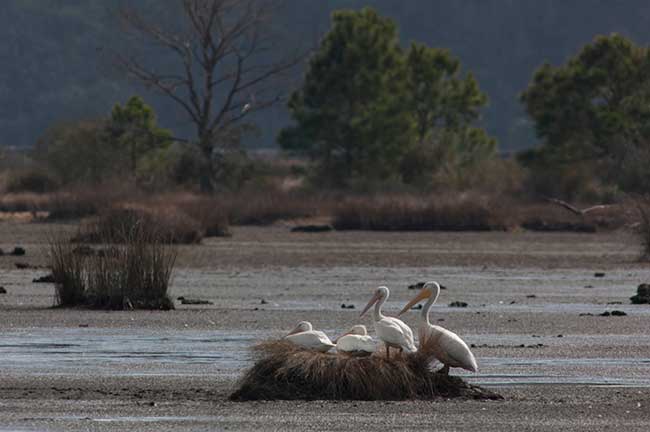
Photograph Gallery of Places of Interest on the Trail
Note: Select thumbnails below to view larger images.